September 7, 2020

Bighorn Mountains, Wyoming

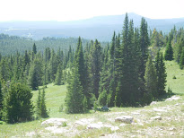
     This is a vast area in the north central part of Wyoming.  We made our way from Ranchester, Wyo. climbing up Hwy 14,  with great views up this road! There are some campgrounds in this 80 x 30 mile forest. There’s a Motor Vehicle Use Map (MVUM) from the  Bighorn forest service for the Avenza App. Most people boondock in the forest. We boondocked, North of Burgess Junction off a forest service road. Routes are diverse, from road riding, 4x4 roads and trails.  Four days, we rode about 50-70 miles per day. 

Bighorns

Creek Crossing, Larry
Flowers and Rocks

Numerous wild flowers

Stone pillars made by shepherds

Numerous moose in area


 We rode to the north, mapping the trails to make a loop. great views from the top, rock outcroppings and cold clear creeks running. There are several bands of sheep, 4,000 in a group with a sheepherder and guard dogs, please give them a wide berth.  Cattle herds can block the road. Cold creeks running, through sagebrush covered hills and forest at the top of the hill. Often you can see a moose, especially if you take a drive after 5pm.

Mike, Janna, Geri, Larry

Clarks, wild flowers and snow

Looking over the edge

Mike, a cow herder's cabin

We were riding one day and stopped and visited with a ranch hand, who stays at a line shack.  He invited us in for coffee and filled us in on the area.  Cattle roaming on the fertile mesas, old buffalo skulls found in the canyons, Indian trails from years ago and bears, elk and moose in the area today. Nothing like hearing about the country from a local!

One day, we hauled down to the south to fs 258 to Shell Creek, we stopped at Upper Medicine Lodge Lake and Painted Rock Lake and campground.  On the return trip, we swung over to Shell Reservoir and never got to Adelaide Lake!

Shell Reservoir

Trail up the sage brush hill


Cowboy and his herd

Painted rocks

We also took a day off to sight see and visited the town of Shell and the Shell Falls Interpretive Site along the way or you can find hiking trails in the area.  There are two lodges, restaurants- Bear Lodge Resort and Elk View Inn, with limited phone service and gas stations near Burgess Junction . There is a public dump station and water fill near the Junction.  Not much for groceries.  A big Thank You to Mike and Janna Clark for sharing this beautiful country we all have to explore.  We have seen such interesting country together!!
High on a hill
More rocks and boulders

Boondocking site

Shell Reservoir

Two years ago we rode the southwestern area also. It is a huge area with a wilderness mountain in the middle of the range.


Numerous hill sides

Sage brush and poplars

August 18, 2019

                                                                                                                                      July 13, 2018

South of Red Lodge, Mt.

Mike and Janna Clark and Larry and Geri Gustafson rode this area, just south of Red Lodge, Mt. on the west side of the road.  I will try to locate the gravel road to turn on where you will find a nice big field to boondock on.  From that camp site, we rode south to 2 great sites.


  The first road travels up the mountain, like a rough 4x4 slow road,  where in the past there has been much mining.  At the end of this road is the Absaroka Beartooth Wilderness Area.  Which is about 10K ft. Of course we thought we were the only ones up there, I should know better by now!!


At the end of the road is a nice waterfall and a trail you can hike to get close to it.  The drive is is amazing with forest and mountain cliff across the stream. This ride was on a FS. road.


Stream at the end of the road


Be sure to drive the Beartooth Hwy over to Cooke City and on to Yellowstone Nat. PK

August 17, 2019

                                                                                                                                         Sept 2018
Panguitch, Utah


Panguitch, Utah , Dixie National Forest, West and East-Red Canyon
Paradise Campground is north of town 3 miles and you can ride to both sides of Hwy 89.

The west is at the the bottom of a mountain, where there is long valley, mostly 4x4 roads, thru short cedar trees.  This is a big area, where I used my GPS to keep track of our routes and I think Avenza. There were grass meadows surrounded by aspen trees. Some areas had burned in the past.


The east area of Hwy 89 was my favorite, lots of sandstone hills with a variety of colors, green, blue, red and white. There are many trails, but well marked.  Valleys, forest on the ridge top and the outstanding Red Canyon, simply breathtaking.


Red Rock Canyon

Larry & Geri in the Red Canyon
                                                                                                                                        July 7, 2018

Mill Creek / Wicked Creek , near Pray, Mt.

    This is mountain and valley areas.  Some of the trails are old logging roads and the ATV trails are very rocky in places.  It well worth the ride.  There were amazing sites, waterfalls, hill sides full of rocks, forest and creeks to cross and snow!!  We came to a big bowl, a lake on the bottom and a circle of snow around the north circle. It felt unusual to be in this spot!


Lake at the top, such an unusual place to experience


The side trail went up the mountain, where we could see where there had been a avalanche and snow was to deep to continue, did I mention this was July 7th?
The main trail seemed to go on forever, we did come across a tree across the trail, so we turned around. Guess we'll have to back and see where it goes.
  This trail is listed on Rider Planet.com under Wicked Creek
Going back down, there's magnificent views going and coming on this trail!!

August 16, 2019

                                                                                                                                    June 28, 2018

Land of Yankee Fork, Challis, Idaho
 
      This is one of our top 5 rides in the USA. It has lakes to the west, 50 inch trail, and regular trails, mountain climbing, old mining camps, water crossings and this year a lot of snow on top!
We camp right in town and ride to the trail heads. The Land of Yankee Fork State Park Visitor center has information on hand and map of Bayhorse trail. You could probably get a MVUM from Salmon Challis National Forest.


Bay Horse area

Ramshorn snow drift


  We rode to the north, where there was a nice lake, easy to reach, further down the rocky, slow going trail, the kind you think your the only ones out there, we came to another lake, and of course there were 4 rigs at the end!!
Volcano edge

This is the trail

We rode over to Bay Horse Trail, up the mountains to the old mining building, sample cores and more. We drove thru valleys, creeks and to the top of Ramshorn Mountain, cold and large snow drifts remaining.  Challis is in the bottom of a volcano crater, and the hills you ride on is the rock that was blown out.  Of course erosion has taken place in the last 20 million years.